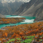


Fairy Meadows, named by German climbers and locally known as Joot, is a grassland near one of the base camp sites of the Nanga Parbat, located in Diamer District, Gilgit-Baltistan, Pakistan.
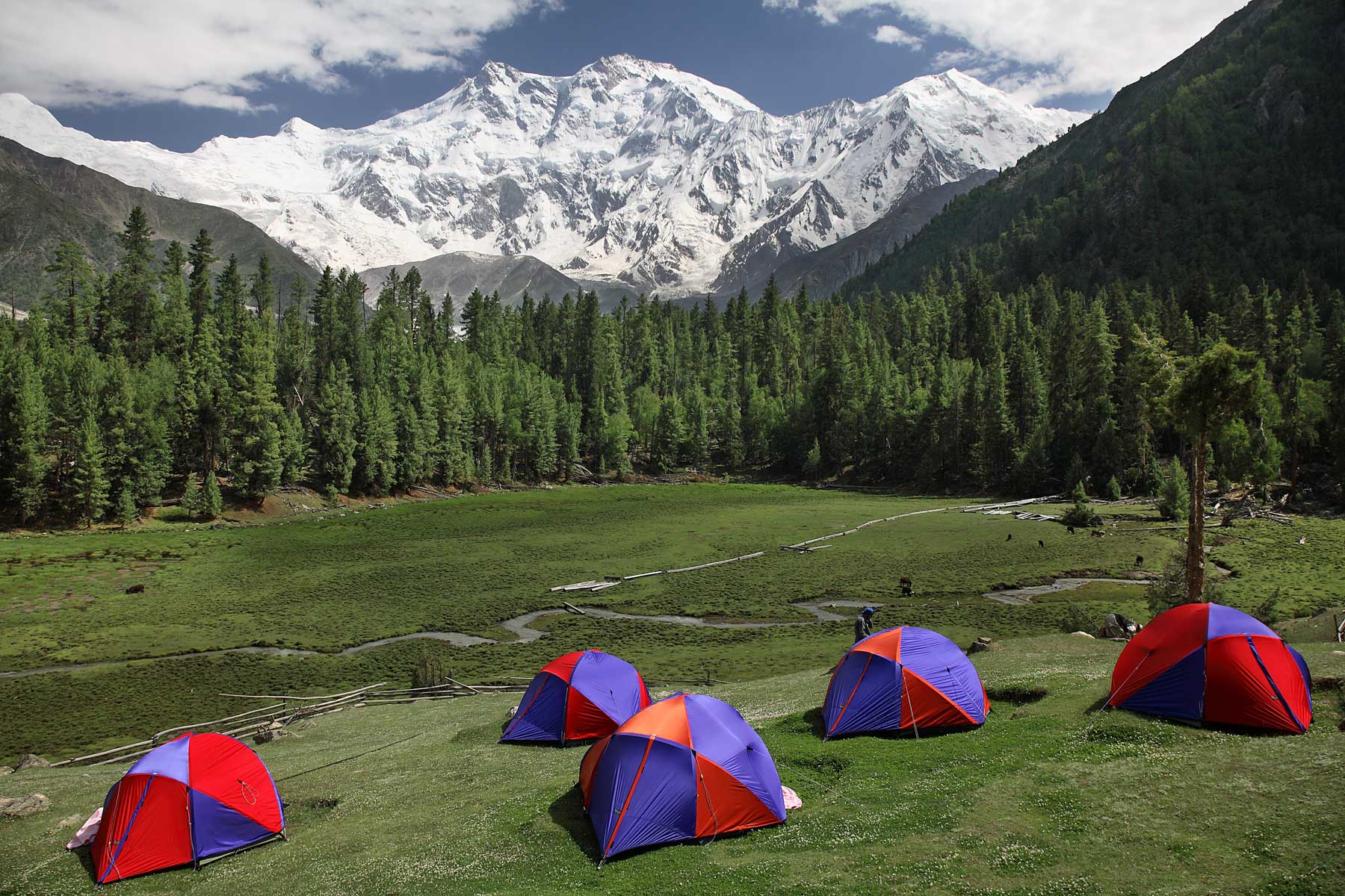
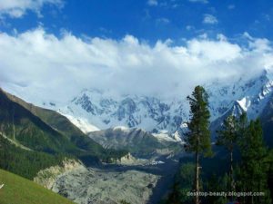
A place which provides an inspiring view of Pakistan’s 2nd highest Mountain Nanga Parbat which at 8126 meters is the 9th highest mountain in the world and 2nd highest in Pakistan after K-2.
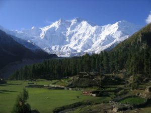
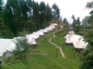
The Fairy Meadows are lush green alpine pastures situated in the middle of a pine forest at an altitude of 3,306 m. The meadows have since long been a thrilling destination for polo lovers, back packers, climbers, wildlife researchers, photographers, painters & geologists, besides nature lovers who spend here a couple of days for real adventure.
Starting high in the Himalayas near the Indus river, the steep and bumpy rocky road swirls up almost 8000 feet on it’s 10 km path. The road takes you to the village of Tattu, from there you begin trekking to the lush green plains of fairy meadows stretching in front of world’s 9th highest mountain Nanga Parbat also coded by mountaineers as “The Killer Mountain”

Fairy Meadows Road is a spectacular high mountain track with a length of 16.2 km (10 miles) located in the Gilgit-Baltistan region of Pakistan. The gravel road is completely unmaintained, there are no guardrails to protect you, and it gets so narrow that near the end you’ll have to cover the last section by walking or biking. Drivers must remain cautious as the pass has been known to claim the lives of careless drivers.
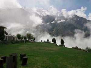
This trail ends in the village of Tato, near Fairy Meadows, a picturesque destination at an altitude of about 3,300 meters above the sea level a high altitude mountain road. Getting to Fairy Meadows is a for the nature lovers who enjoy the view.
Please visit our website for fairy Meadows tour packages at: http://travelstourism.com/fairy-meadows/