
Gilgit Baltistan former known as “Northern Areas” is the most spectacular and fascinating region of Pakistan. Here world’s three famous mountain ranges meet, Himalayas, Karakorums and Hindukush.
Gilgit Baltistan is the most spectacular and fascinating region of Pakistan. It is here that the world’s four famous mountain ranges meet – the Himalayas, the Karakorams, the Hindukush and the Pamirs. The whole Gilgit-Baltistan has come to be known as a paradise for mountaineers, climbers, trekkers, hikers and anglers of the most famous “Trout fish”.
Gilgit Baltistan at a stone’s throw from the Amu Darya, is” Bam-e-Dunya” (the roof of the world). This was the name given to the great Pamir plateau, apex of six of the mightiest mountain ranges of the world.
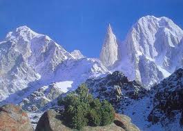
The historic Karakorum pass (5,575 metres) an ancient trading route between Kashmir and Xinjiang gives its name to the range west of it that forms the watershed between the Indus and the Central Asian deserts. The eastern boundary of the Karakorum is the upper Shyok River from where it extends over 322 km. westwards to the Karumbar river and the Hindukush range. To the north the Shaksgam tributary of the Yarkand River and south by the Indus bound the Karakorum. Here the Nanga Parbat 8,126 metres massif is the western anchor of the great Himalayan range which stretches in an arc 24,124 km. east to Burma, a boundary and barrier, “the razor’s edge” which for centuries has determined the destiny of the South Asia.
Karakorum Mountain Range remnant of a primeval ice age, “the third pole,” with extensive glacier systems and the greatest concentration of lofty mountains in the world. Some of the largest glaciers outside sub-polar regions flow in the Karakorums. For its sheer mountain grandeur and breath-taking panorama of beauty few places can match the superb landscape
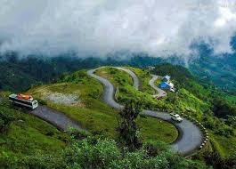
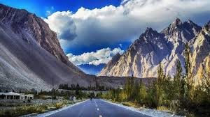
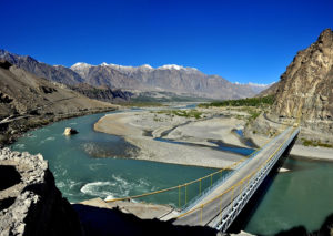
Karakorum Highway (KKH) A fantastic and unforgettable spectacle is the passage of the Highway along the Baltura glacier rated among the worlds seventh largest.
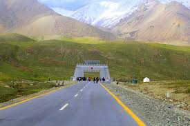
Khunjerab Pass which the Highway crosses and the nearby Mintaka Pass lie astride the fabulous ancient Silk Route that led from Europe to Asia and over which history’s most famous tourists once traveled.
Siachin glacier 75 km, Hispar, (52 km) joints the Biafo at the Hispar La 5,154 meters to form an ice corridor, 116 km. long. Batura too is 58 km. in length. But the most outstanding of these rivers of ice is the Baltoro (62 km). This mighty glacier fed by some 30 tributaries constitutes a surface area of 1,219 sq. km. Of the fourteen over 8,000 meters peaks on earth, four occupy an amphitheater at the head of Baltoro. There are K-2 (8,611) second only to Everest, Broad Peak (8,047 meters) Gasherbrum I (8,068 meters), Gasherbrum II (8,035 meters).
Karakoram pass 5,575 metres, an ancient trading route between Kashmir and Xinjiang, gives its name to the range west of it that forms the watershed between the Indus and the Central Asian deserts. The eastern boundary of the Karakoram is the upper Shyok River from where it extends over 322 km. westwards to the Karumbar river and the Hindukush range for its sheer mountain grandeur and breath-taking panorama of beauty, few places can match the superb landscape through which the Karakoram Highway snakes. A fantastic and unforgettable spectacle is the passage of the Highway along the Baltura glacier, rated among the worlds seventh largest. Khunjerab Pass highest border between any two countries on the face of the earth.
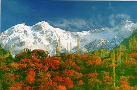
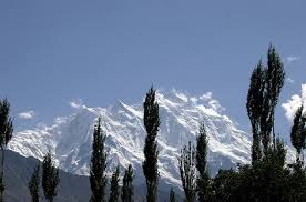
Rakaposhi 7,788 metres, the dominant giant in Hunza valley. Its north face is fantastic precipice 5,791 metres of snow and ice.
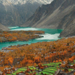
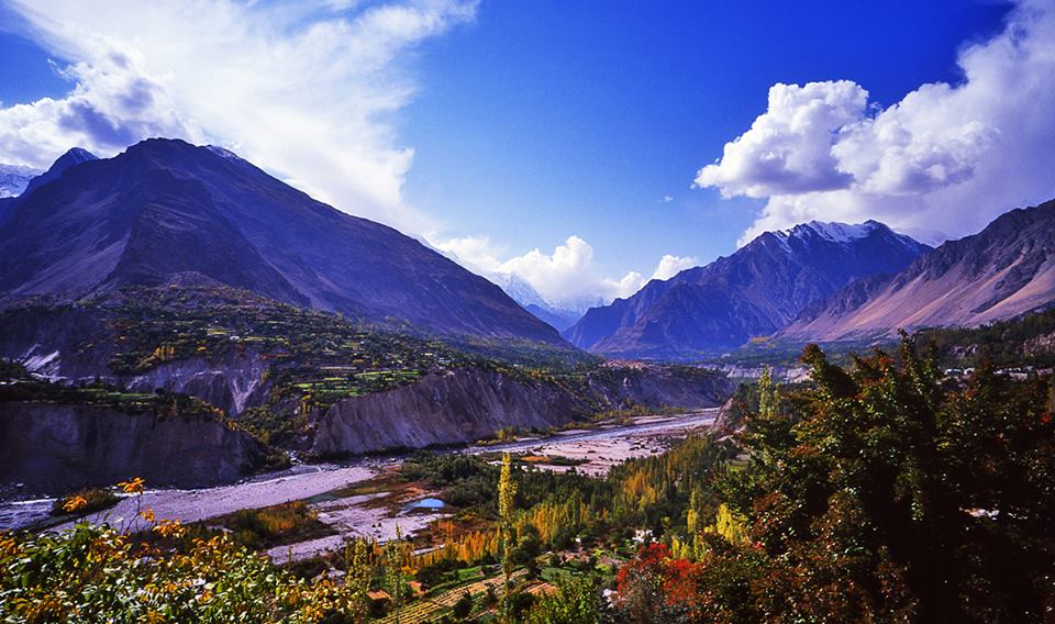
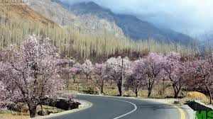
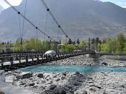
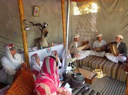
Hunza Valley The visitors to Hunza are overwhelmed by the rugged charm, the fragrant breeze singing through graceful Poplar trees and the velvet-like green carpet of wheat fields, set against the background of snow-covered mountains.

Situated at an elevation of 2,438 meters, Hunza Valley’s tourist season is from April to October. The temperature in May is maximum 27 C and minimum 14 C. The October temperature are: maximum 10 C and minimum 0 C. However, one can visit Hunza round the year.
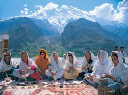
Most of the people of Hunza are Ismaili Muslims, followers of His Highness the Aga Khan. The local language is Brushuski. Urdu and English are also understood by most of people.
Karimabad capital of Hunza Valley offers an inspiring view of Rakaposhi 7,788 meters. Snows of Rakaposhi glitter in the moonlight producing an atmosphere at once ethereal and sublime.
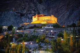
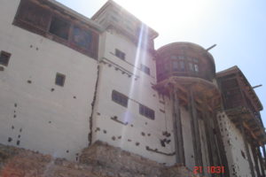
The fairy-tale like castle of Baltit at Karimabad is Hunza landmark built about 600 years ago. Stilted on massive wooden legs, its wooden bay windows look out over the valley.
Originally it was used as the residence of the “Mirs” the title of the former rulers of Hunza.
Mountaineering And Hiking Hunza is ideal for mountaineering, trekking and hiking. Most of the treks in Hunza area are in open zone for which tourists do not need any permit. However special permits are required from the Ministry of Tourism in Islamabad for mountaineering, trekking in restricted zone and climbing peaks over 6000 meters.
For visiting Gilgit and Hunza Valleys please check out our different tour packages at: http://travelstourism.com/gilgit-hunza-honeymoon-family-group-tours/